Historical Spaces
Foregrounding the subject of Historical Spaces may seem anachronistic since art historians and others have been dealing with it for a very long time. However, things have changed with the ‘spatial turn’: the notion that spaces are not simply (re)presented in various media, but above all created by these very media, has finally gained acceptance. Nevertheless, great efforts still need to be made, particularly in art history, in order to determine how the understanding and mediatisation of historical space can be methodically analyzed.
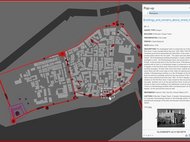
Several projects in the Department are dealing with this phenomenon and the methodological problem of how to analyze it by questioning how historical spaces were and are conceived and constructed through media. This applies to digital reconstructions of historical sacred spaces as well as to the deconstruction of historical spaces in texts, images, and maps. These representations seem to provide immediate access to historical spaces, and yet they have their own agenda and historical conditioniality, which must be analyzed in order to adequately understand their conceptual and mediatic framework.
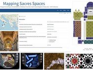
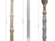
The Mapping Sacred Spaces project is conducting basic research on medieval liturgical spaces. In addition to collecting data in an innovative database and digitally reconstructing liturgical arrangements that have often been significantly altered, the project also involves reflecting on the methods of the reconstructions themselves as well as applying machine learning to recognise and compare patterns in the decoration and ornamentation of liturgical furnishings. Complementing other results and outcomes, this is expected to lead to fundamentally new insights into the medieval construction of inlaid work.
In recent years, we have increasingly focussed on the possibilities and limitations of digital tools. Digital tools for mapping and three-dimensional reconstruction have been tested and discussed in workshops and regular working meetings. The first results (discussed – due to Covid – in an online-workshop) have been published in the second volume of our digital publication series (Hertziana Studies in Art History): Visualizing Complexities. Practices and Heuristics of Digital Models in Art History, 2023.
Every piece of data entered into a model or a representation generates meaning in relation to the others; this principle is as valid for digital maps as it is for all maps. It is therefore important to think carefully about what one wants to show on a self-created map, which still has a tendency to essentialise its information. The so-called white spots also have a significance, as they may hide important information and produce a distorted version of the area. It becomes even more complicated with three-dimensional reconstructions, because a visual representation is able to depict uncertainties only with great difficulty. In the (digital) image of a three-dimentional space, many (e.g., grey) undefined spaces create an unpleasant effect; indeed, in most cases we know very little about the specific historical space in which we are, for example, virtually assigning positions to liturgical furnishings or artworks that have been displaced from their original context. The challenge in the future is to frame digital reconstructions (also and especially for a wider audience) visually and argumentatively in such a way that their status as possible interpretations is understood, and they are not mistaken for representations of historical reality.
