COLONIA AGRIPPINA EXACTISSIME DESCRIPTA
Tatjana Bartsch

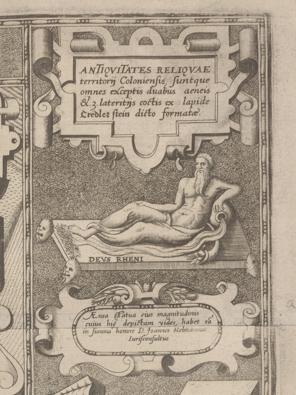
The so-called Mercator Plan was created in 1570-1571 by Arnold Mercator, the son of the famous globe builder, cartographer and cosmographer Gerhard Mercator. It is the first city map of the free city of Cologne based on exact measurements. Due to its large format of 110 × 173 cm, it depicts the city with unprecedented accuracy. The complex design of the city’s topography and the additional elements such as the decorative border strips and the text fields set in scroll boxes make it one of the most cartographically demanding and at the same time aesthetically appealing Renaissance city maps. A large number of Roman antiquities found in the city, so-called Antiquitates Coloniensis, are depicted on two vertical strips on the left and right, and are provided with inscriptions, dimensions, and indications of origin. Thus, the Mercator Plan is the first comprehensive, written and printed source on the ancient architectural and pictorial heritage of Cologne. Most of the artifacts depicted are today lost. The illustrations of the margin strips are therefore of great value not only for topographical and urban history, but also have significance for archaeological research and research into the history of collecting.
The historiographical orientation of the city plan and the contents of the framed texts and illustrated margins were decisively influenced by the political and humanistic interests of the Cologne aldermen, who were also the owners of the Antiquitates. In addition to the material analysis of the surviving copies and the preparatory drawings, the study of the plan includes the exploration of the areas of interest of its creator, his patrons, and the Cologne network of humanist scholars around Jean Matal, as well as the investigation of the cartographic process used. This process employed a combination of orthogonal and isometric representation, whereby a perspective view of the city was created on the basis of an area-related orthogonal plan produced by means of triangulation and with the aid of plastic representation elements. Its main purpose was to make the long and glorious history of the COLONIA AGRIPPINA and its inhabitants experienceable in the city topography and beyond, and in this manner function as an instrument of knowledge. The results were published in 2024 in a catalogue contribution to an exhibition on the reception of antiquity north of the Alps.
